Satellite & aerial image processing
Our remote sensing capabilities allow us to analyze vast stretches of land, track environmental changes, and provide data-driven insights without physical contact. We leverage satellite data to inform strategic decisions.
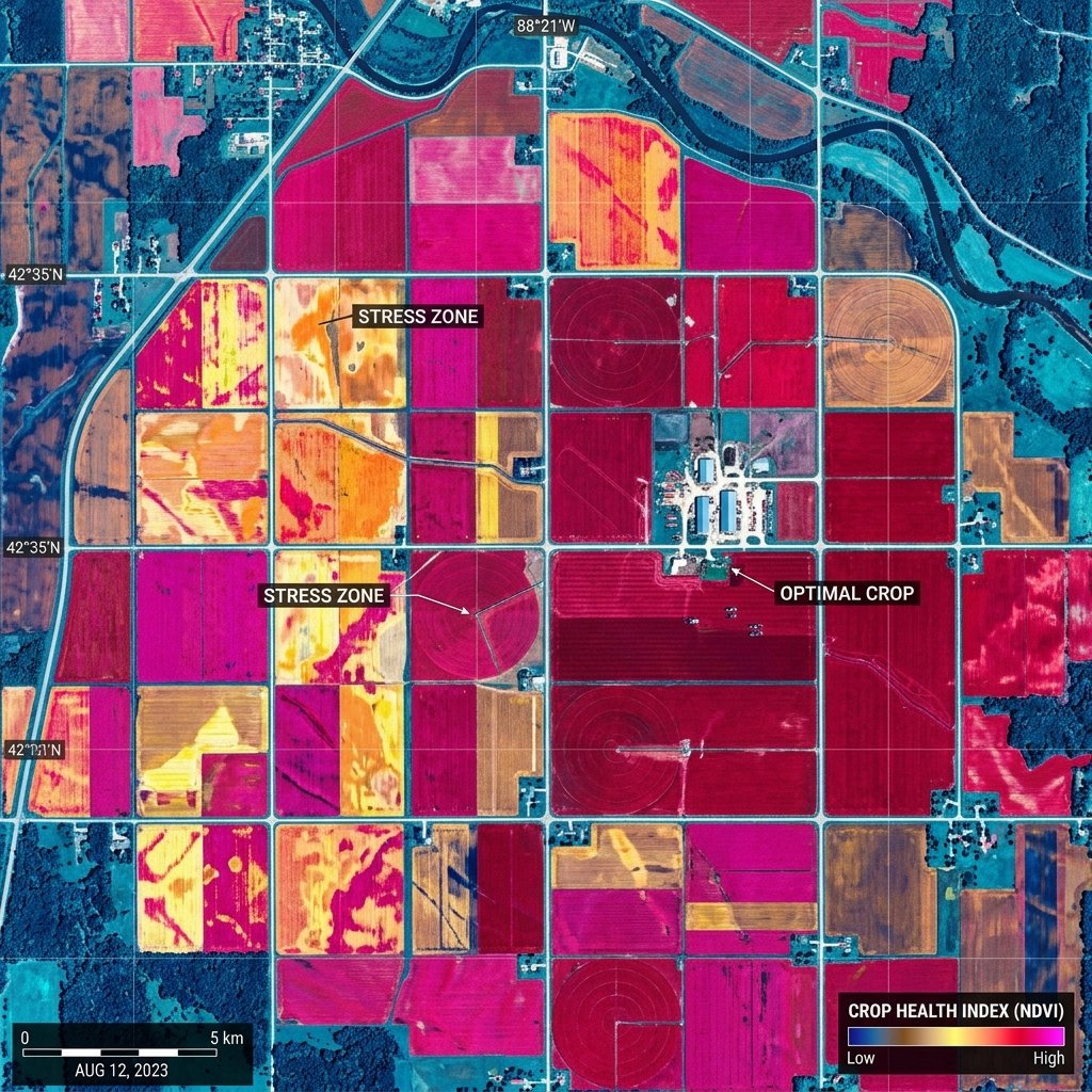
Crop identification, yield estimation, and agricultural health monitoring using multi-spectral imagery to boost efficiency.
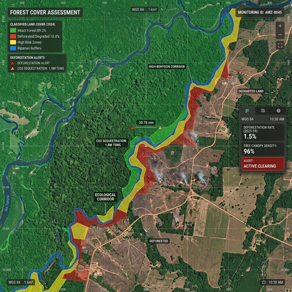
Monitoring deforestation, afforestation efforts, and conducting wildlife habitat analyses through temporal satellite data.
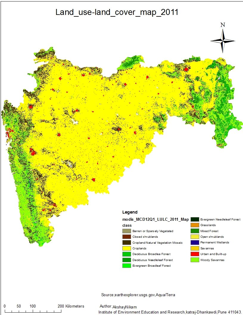
Tracking historical land use and land cover (LULC) transformations to support regional planning and EIA models.